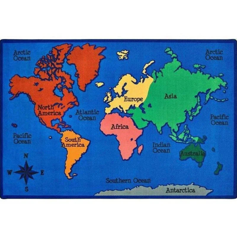
Bring global learning to your floor with our vibrant World Map ClassroomRug. This eye-catching floor covering. Ideal for classrooms, playrooms, or play areas. This rug offers an engaging way to introduce geography.
Sizes: 6' x 9' and 8' x 12'
Features:
- Colorful continents: North America (red), South America (orange), Europe (yellow), Africa (pink), Asia (green), and Australia (dark green)
- Clearly labeled major oceans: Pacific, Atlantic, Indian, Arctic, and Southern
- Antarctica depicted along the bottom edge
- Compass rose for directional learning
- Bold blue background representing Earth's vast waters
Its durable construction stands up to active play while providing a soft surface for sitting and exploring. Make learning about our world fun and interactive with this colorful, educational floor map!"
About : We have been given access to a small inventory of irregular classroom-style rugs that do not meet the rigid first quality standards of Carpets for Kids.
This is a brand new rug that may include a slight color change, small dye spots, a slight backing flaw or a seam that hasn't been sewn perfectly straight.
- Anti Static and Anti Stain Protection
-
Meets NFPA 253, Class 1 Firecode
- Double-stitched serged edges
- Assists in allergen particle control
- Meets the CRI s Green Label Plus certification
Made by Carpets for Kids
Here are 10 interesting facts about world maps:
- The first known world map dates back to ancient Babylon, created around 600 BCE on a clay tablet.
- The Mercator projection, one of the most commonly used map projections, was introduced in 1569. It distorts the size of landmasses, making regions near the poles appear much larger than they actually are.
- The map orientation with north at the top became standard in the Western world, but many ancient maps had different orientations, with east or south at the top.
- The word "geography" comes from the Greek words "geo" (earth) and "graphein" (to write or describe).
- Antarctica was the last continent to be discovered, first sighted in 1820 by a Russian expedition led by Fabian von Bellingshausen.
- The International Date Line, an imaginary line passing through the Pacific Ocean, allows for the dating of a day to change as one travels across it.
- The Dymaxion map, created by Buckminster Fuller in 1943, is a unique world map projection that depicts the entire Earth's surface on a single flat surface without significantly distorting the relative size of the landmasses.
- The world's largest wall map, measuring 59 feet by 27 feet, is displayed at the National Geographic Society's headquarters in Washington, D.C.
- The world map used in the United Nations logo is the Peters projection, which aims to accurately represent the relative sizes of the world's landmasses.
- Many early world maps included mythical or fantastical elements, such as sea monsters, mermaids, and unexplored regions labeled with phrases like "Here be dragons.

